News

  • We took part in the 'Data Challenge: Mobile Phone Data' by BERD@NFDI

    To foster our connections within the NFDI (Nationale Forschungsdateninfrastruktur) we took part in the “Data Challenge: Mobile Phone Data” by Berd@NFDI at Ludwig Maximilian Unviersity of Munich (LMU).

    During this workshop we had the opportunity to discuss with practicioners from fields like economics and social sciences on how they use mobility data, and more explicitly mobile phone data to answer reasearch questions in their applciation domain. Interestingly, questions like privacy-restrictions and the evaluation of large datasets were the main concerns there and align exactly with issues identified in our research (Mokbel et al., 2024). Further, we especially contributed with discussing our idea on trajectory anonymization (compare (Walther et al., 2024)) and developed ideas for future coollaborations with other institutes.

    Resources

    1. Mokbel, M., Sakr, M., Xiong, L., Züfle, A., Almeida, J., Anderson, T., Aref, W., Andrienko, G., Andrienko, N., Cao, Y., Chawla, S., Cheng, R., Chrysanthis, P., Fei, X., Ghinita, G., Graser, A., Gunopulos, D., Jensen, C. S., KIM, J.-S., … Zimányi, E. (2024). Mobility Data Science: Perspectives and Challenges. ACM Trans. Spatial Algorithms Syst. https://doi.org/10.1145/3652158 [Online]
    2. Walther, P., Luo, X., & Werner, M. (2024). TraBiMap: Reducing Privacy Concerns in Trajectory Analysis with Randomized Data Representations. 2nd ACM SIGSPATIAL International Workshop on Geo-Privacy and Data Utility for Smart Societies. https://doi.org/10.1145/3681768.3698496 [PDF] [Online]
  • EduHub NFDI4Earth Introduction Course to Python

    Students in the Python course
    Students in the Python course(c) 2024 H. Li
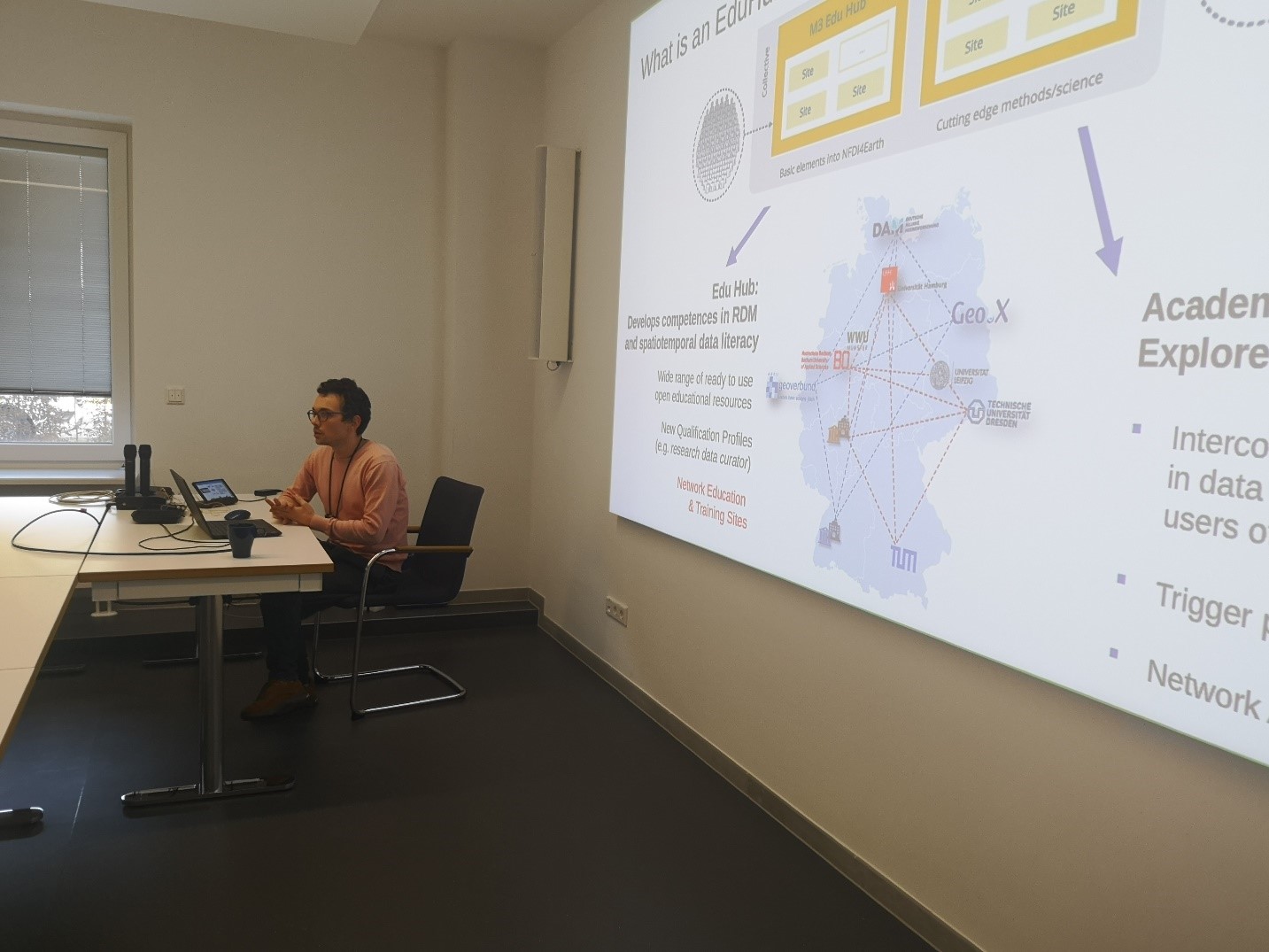
    Balthasar Teuscher introducing NFDI4Earth EduHub concept
    Balthasar Teuscher introducing NFDI4Earth EduHub concept(c) 2024 H. Li

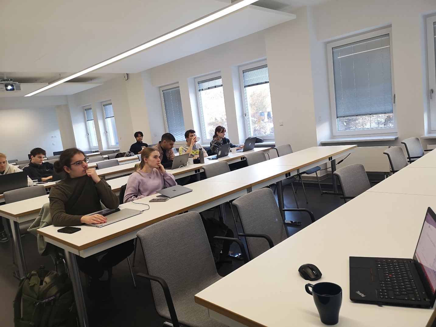
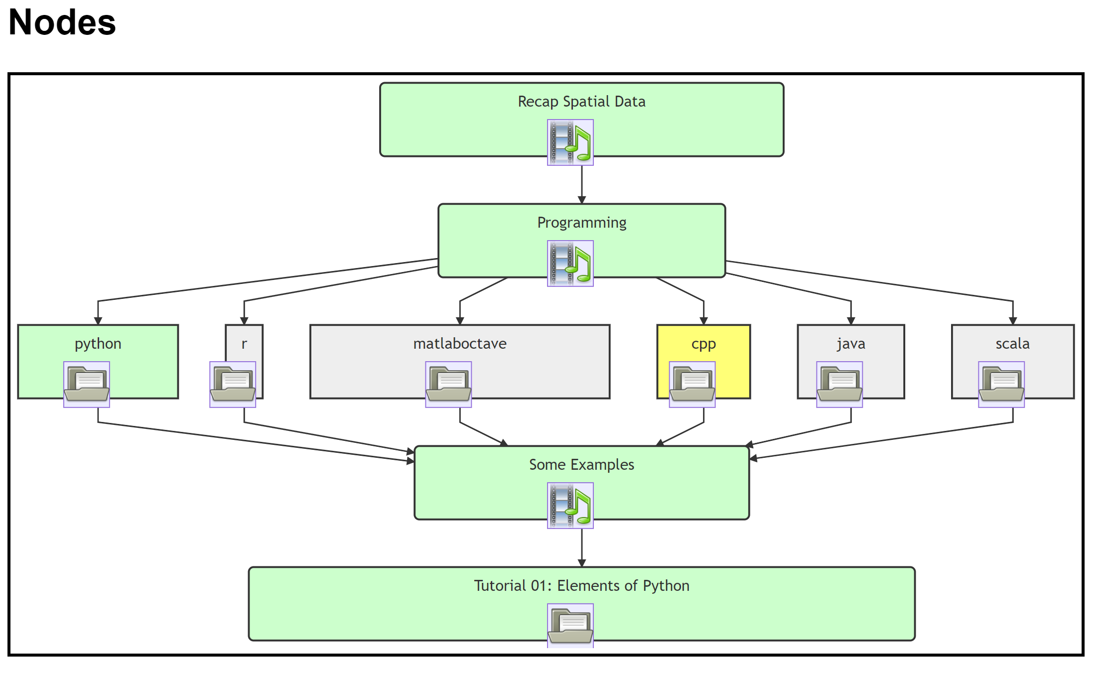
    On November 06, we have an open course offered to students from Aerospace and Geodesy, and more than 10 students joined both in-present and online. The topic is “Introduction Course to Python”, where basic Python programming language concepts (like syntax, variables, data types, operators, control flow, etc) were covered. Besides, we also introduced basic concepts of Spatial Data mining and Machine Learning with selected examples.

    This EduHub course is offered regularly with free registration for both Bachelor and Master students to gain a first impression about Python programming.

    For information about the future EduHub course, please refer to: Research Seminar

  • ACM MULTIMEDIA 2024 - Challenge on Drone Localization won again.

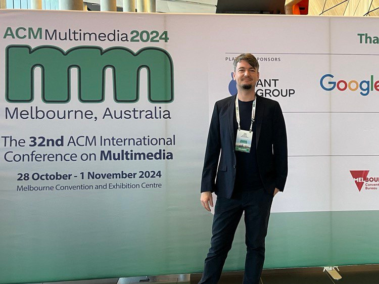
    Fabian Deuser at Melbourne where he presented our winning solution to the visual drone localization challenge
    Fabian Deuser at Melbourne where he presented our winning solution to the visual drone localization challenge(c) 2024 F. Deuser

    End of October 2024, we were again invited to the respected ACM MULTIMEDIA conference to present our approach to estimating the location of a drone using only camera information.

    We have been winning this challenge in 2023, already, and, thus, we are proud to win the second time in a row. Among all submissions, our current submission was ranked #1 with best location accuracy. Congratulations to the team and we are proud having demonstrated that TUM Aerospace and Geodesy is able to localize their drones precisely.

    Details about the method of this year can be found in the upcoming publication.

  • EduHub Kick-off Seminar: Talk on Spatial Data Science Delivered by Yomna Eid

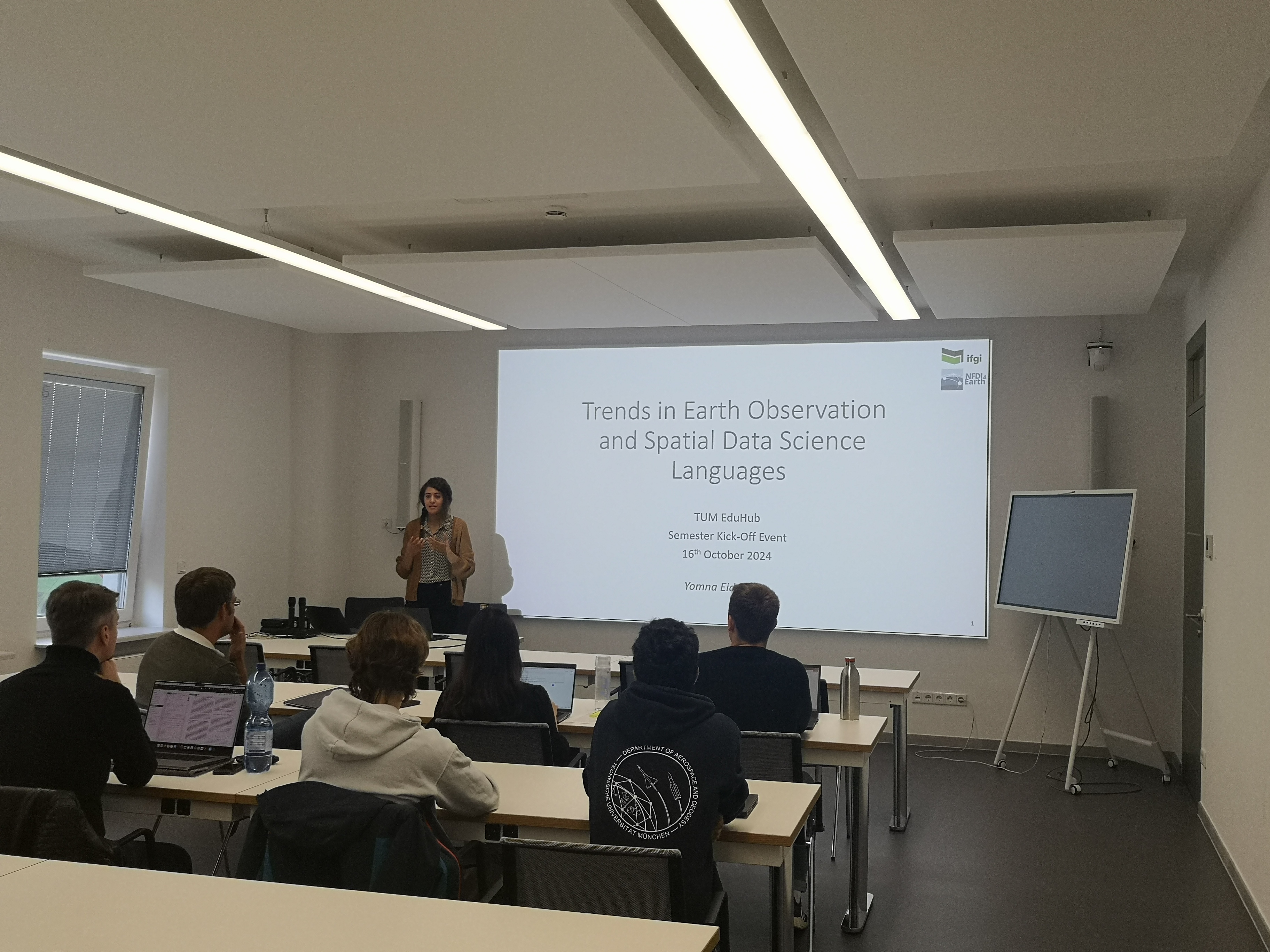
    Yomna Eid presenting her latest research
    Yomna Eid presenting her latest research(c) 2024 H. Li

    On October 16, the room was packed with colleagues and students when Yomna Eid (ifgi, Uni Münster) presented us her latest research on how EO data down-sampling impact the quality and accuracy of analysis results, as well as lessons learned from the Spatial Data Science across Languages (SDSL) workshop. The talk was very interesting and the follow-up discussion was live and inspiring.

    This guest talk is embedded into the ongoing EduHub activity and kicks off the Research Seminar series for Winter Term 2024/2025.

    For information about the EduHub and upcoming events, please refer to: Research Seminar

    Resources

  • We have 5 papers at the ACM SIGSPATIAL GIS conference in Atlanta, USA

    We are very happy to be such well represented at this year’s 32nd ACM SIGSPATIAL International Conference on Advances in Geographic Information Systems (ACM SIGSPATIAL 2024) and associated workshops in Atlanta, USA.

    Research Papers

    We are excited to present the following scientific papers:

    1. Calculating Upstream Relation in Spatial Networks Under Path Constraints (Main Track)
      Authors: Wejdene Mansour, Martin Werner

    2. SRL: Towards a General-Purpose Framework for Spatial Representation Learning (Vision Track) Authors: Gengchen Mai, Xiaobai Yao, Yiqun Xie, Jinmeng Rao, Hao Li, Qing Zhu, Ziyuan Li, Ni Lao

    3. PC-LMT: The Point Cloud Log Merge Tree for the Helena Point Cloud Database (BigSpatial’24 Workshop)
      Authors: Balthasar Teuscher and Martin Werner

    4. Random Affine Transformation Feature Representation Learning for Fast Polygon Retrieval (GeoSearch’24 Workshop)
      Authors: Zhangyu Wang, Xingyi Du, Hao Li and Martin Werner

    5. TraBiMap: Reducing Privacy Concerns in Trajectory Analysis with Randomized Data Representations (GeoPrivacy’24 Workshop)
      Authors: Paul Walther, Xuanshu Luo and Martin Werner

    Posters

    Apart from this we also have a poster in the TSAS poster track:

    1. Mobility Data Science: Perspectives and Challenges Authors: Mohamed Mokbel, Mahmoud Sakr, Li Xiong, Andreas Züfle, Jussara Almeida, Taylor Anderson, Walid Aref, Gennady Andrienko, Natalia Andrienko, Yang Cao, Sanjay Chawla, Reynold Cheng, Panos Chrysanthis, Xiqi Fei, Gabriel Ghinita, Anita Graser, Dimitrios Gunopulos, Christian S. Jensen, Joon-Seok Kim, Kyoung-Sook Kim, Peer Kröger, John Krumm, Johannes Lauer, Amr Magdy, Mario Nascimento, Siva Ravada, Matthias Renz, Dimitris Sacharidis, Flora Salim, Mohamed Sarwat, Maxime Schoemans, Cyrus Shahabi, Bettina Speckmann, Egemen Tanin, Xu Teng, Yannis Theodoridis, Kristian Torp, Goce Trajcevski, Marc van Kreveld, Carola Wenk, Martin Werner, Raymond Wong, Song Wu, Jianqiu Xu, Moustafa Youssef, Demetris Zeinalipour, Mengxuan Zhang, and Esteban Zimányi.

    Workshops

    We are delighted to co-host the:

    3rd ACM SIGSPATIAL International Workshop on Searching and Mining Large Collections of Geospatial Data Workshop Co-Chairs from our group: Hao Li, Martin Werner Description: Engage with experts in the efficient searching and mining of large geospatial data collections, contributing to the development of cutting-edge solutions.

    Additionally Martin Werner serves as a Poster/Demo Chair at the main conference.

    For further information about our participation and research reach out to us on the conference. We look forward to sharing insights, learning, and contributing to the vibrant academic community at SIGSPATIAL ‘24. For detailed information on all our published papers refer to the publications page.

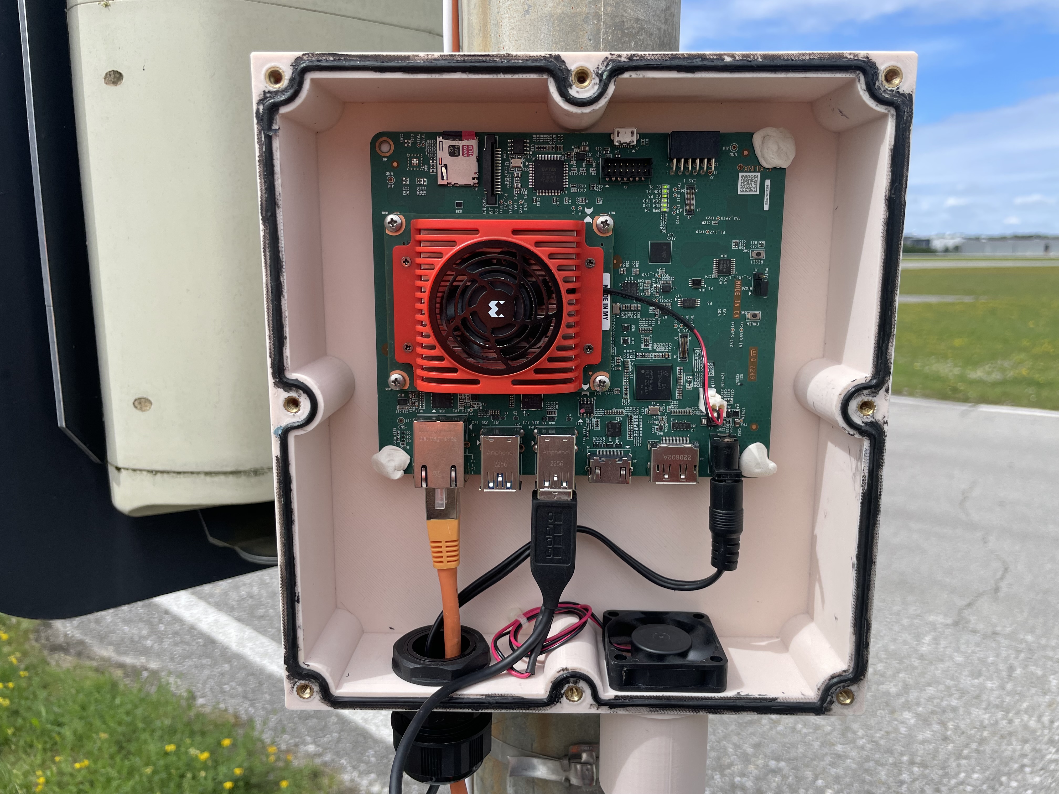
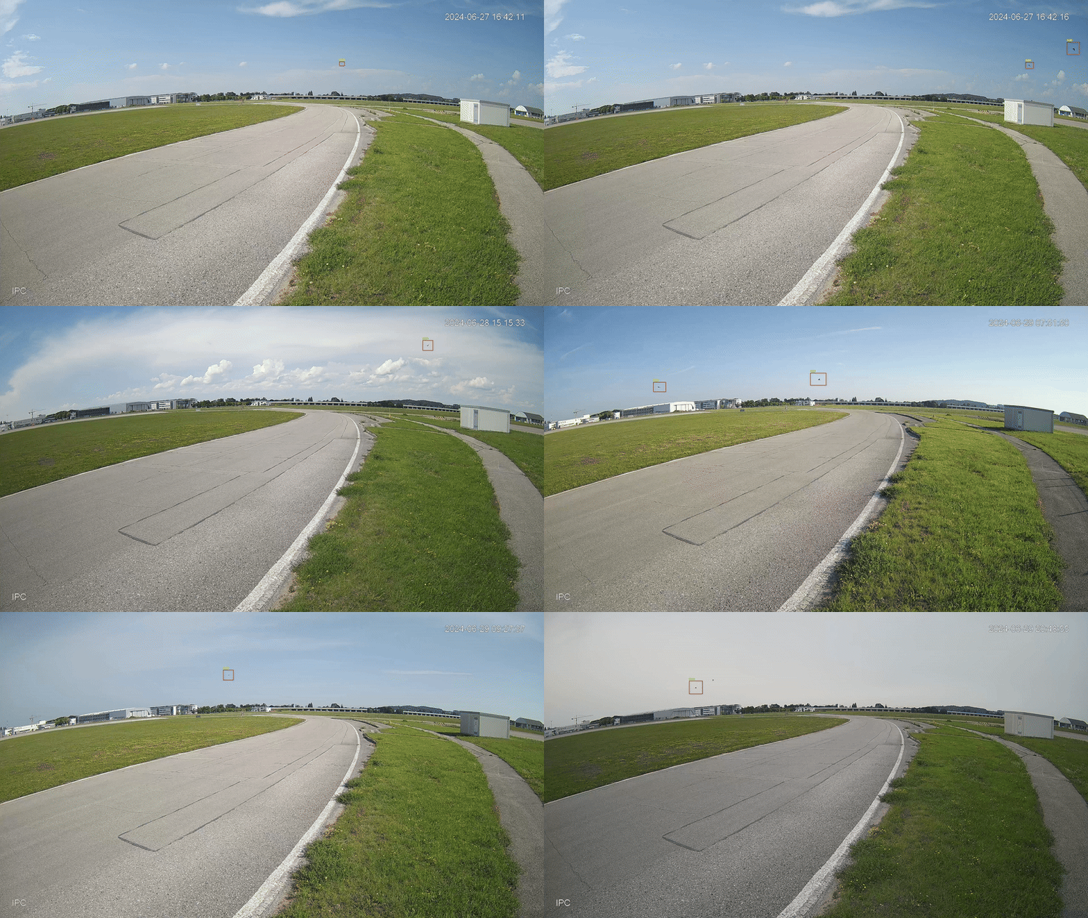
  • Our FPGA-accelerated bird detector is now working at Airport Oberpfaffenhofen.

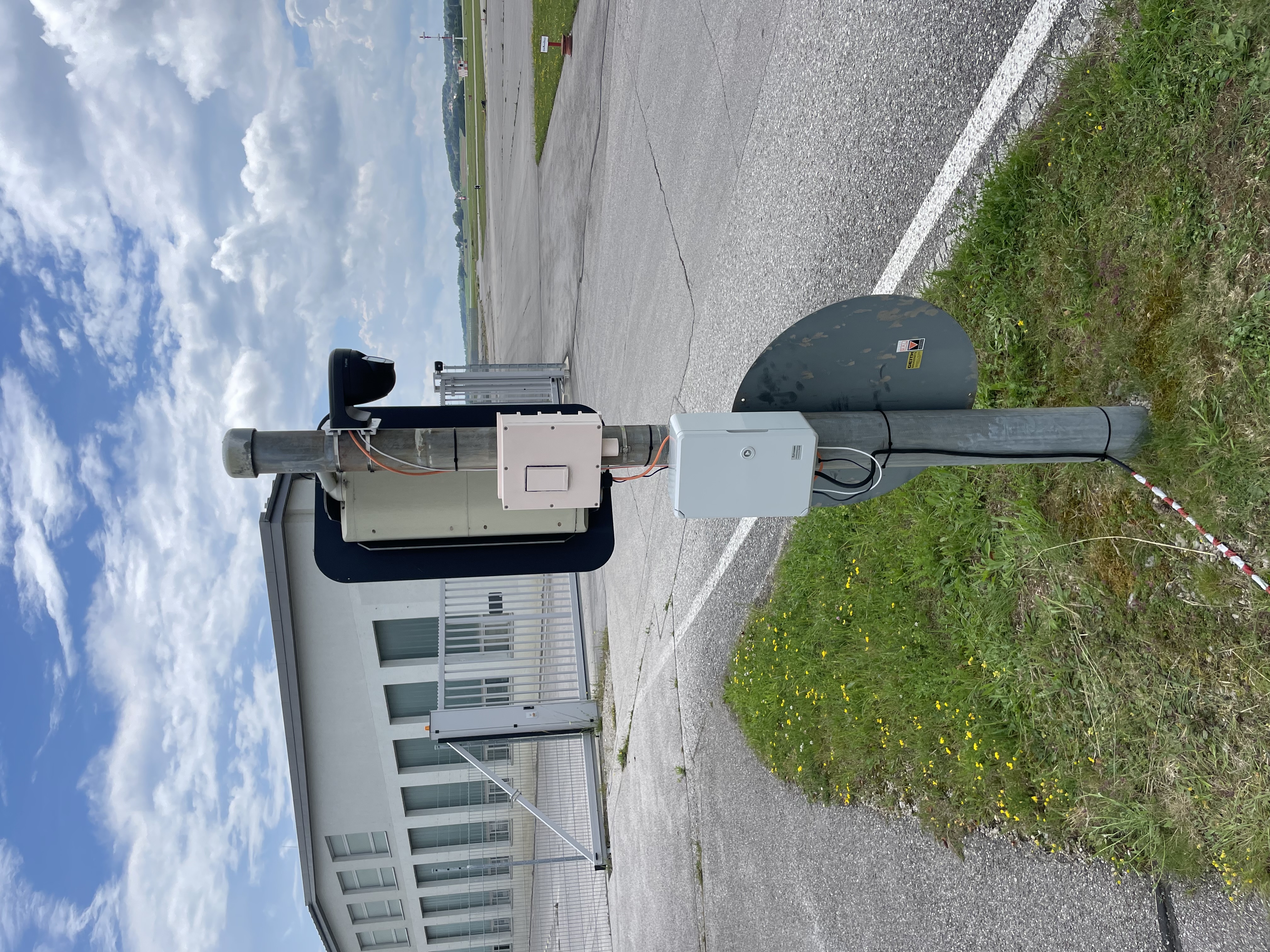
    Our FPGA-accelerated bird detector at Airport Oberpfaffenhofen
    Our FPGA-accelerated bird detector at Airport Oberpfaffenhofen(c) 2024 TUM
    The container for the FPGA and cable connection
    The container for the FPGA and cable connection(c) 2024 TUM
    The container for the FPGA and cable connection
    The container for the FPGA and cable connection(c) 2024 TUM

    Our bachelor student, Gabor Fogarasi, deployed an FPGA-accelerated bird detector at Airport Oberpfaffenhofen for bird strike prevention based on his engineering project in WiSe 23/24, as part of Brandenburg / Bayern Action for AI Hardware (BB-KI Chips).

    The underlying detection model was pre-trained by quantization-aware training to reduce the model size and increase inference speed using low-precision model parameters. Experiments show 50 times faster detection speed without significantly compromising accuracy than the uncompressed model. The massive parallelism of FPGA further ensures the efficiency of online inference.

    Birds are monitored by an IP camera connected to the FPGA board running the detection model in the backend at approx. 2 FPS for 4K inputs. A 3D-printed detector container is also designed for essential waterproofing and heat sinking. The gif shows some birds detected at the scene.

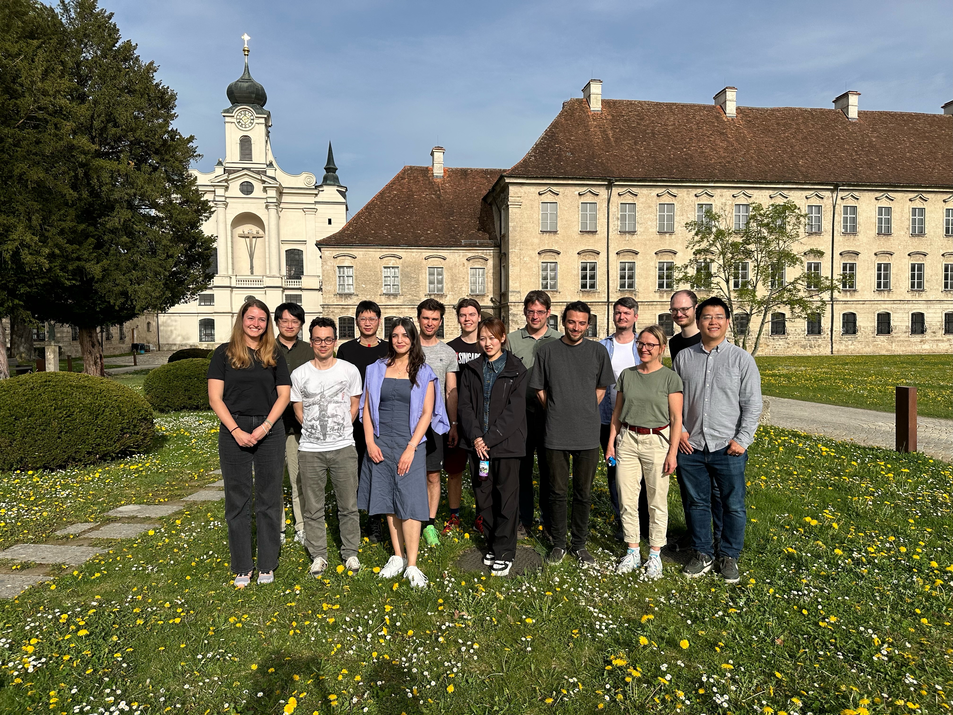
  • Our team had its regular workshop in Raitenhaslach

    Our group in Raitenhaslach
    Our group in Raitenhaslach(c) 2024 TUM
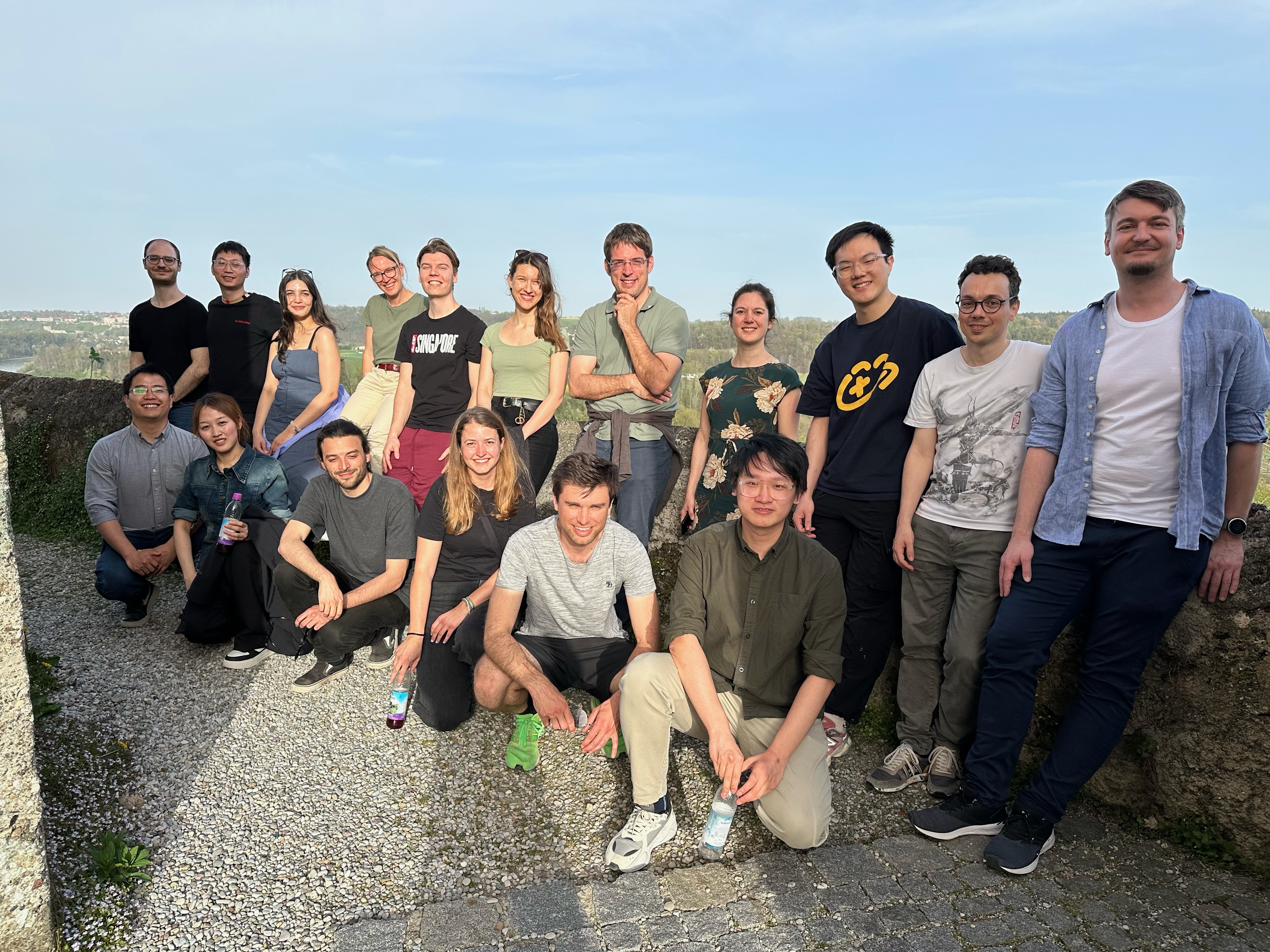
    Joint groups of BGD and RSA during our hike to church Marienberg
    Joint groups of BGD and RSA during our hike to church Marienberg(c) 2024 TUM

    Our group just had a workshop in Raitenhaslach, which took place from April 8th to 9th. During these two days, we joined forces with Katharina Anders’ Group for “Remote Sensing Applications” to work on two topics:

    Assess the working progress of all different projects and dissertations and develop new ideas for our research. For the first, all Ph.D. students presented their current status and results, while for the second part, we chose the interactive format of research speed dating. Both parts allowed learning about the different focus topics of all the group members and develop new ideas for innovative research approaches in the future.

    Apart from the research-oriented program points, this event also left plenty of opportunities to connect with the other BGD fellows and grow together as a team. We walked together to the Marienberg church and enjoyed the summer-like weather in April. We are already looking forward to the next workshop!

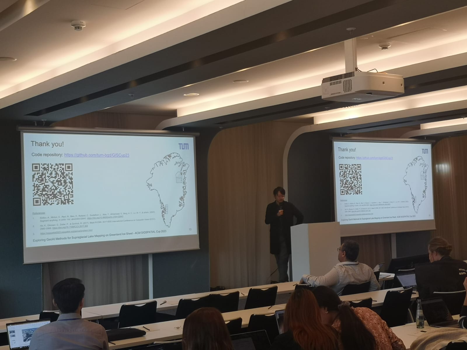
  • We won the 2nd place in the GISCUP at ACM SIGSPATIAL

    Xuanshu Luo presenting our results at SIGSPATIAL 2023
    Xuanshu Luo presenting our results at SIGSPATIAL 2023(c) 2023 H. Li

    In a significant achievement, we, the Professorship for Big Geospatial Data Management, have clinched the 2nd place in the 12th SIGSPATIAL Cup competition (GISCUP 2023). Our winning paper, “Exploring GeoAI Methods for Supraglacial Lake Mapping on Greenland Ice Sheet,” stands as a collaborative effort by our dedicated research team – Xuanshu Luo, Paul Walther, Wejdene Mansour, Balthasar Teuscher, Johann Maximilian Zollner, Hao Li, and Martin Werner (Luo et al., 2023).

    GISCUP, conducted alongside the 2023 ACM SIGSPATIAL conference, is an annual contest hosted by SIGSPATIAL to foster innovation in geospatial research. The official announcement of the winners took place at the ACM SIGSPATIAL conference in November 2023.

    The focus of this year’s challenge was on the auto-identification of supraglacial lakes on the Greenland ice sheet from satellite imagery. Our goal was to develop an automated system capable of tagging these lakes as polygons from a single image, aiding in the tracking of their behavior across multiple summer melt seasons. Our winning paper showcases the practical application of Computer Vision Models to address this specific challenge. Additionally we investigated the potentials of the new category of large foundation models, namely the Segment Anything Model (SAM), in this field of research.

    The SIGSPATIAL Cup win also brings with it a Travel Grant to the 2023 ACM SIGSPATIAL conference, providing us with the opportunity to present our work and engage with experts in the geospatial community. Such, our success in the GISCUP reinforces our standing as contributors to practical and innovative geospatial research.

    If you are interested in our research, also take a look at the corresponding Github Repository.

    Resources

    1. Luo, X., Walther, P., Mansour, W., Teuscher, B., Zollner, J. M., Li, H., & Werner, M. (2023). Exploring GeoAI Methods for Supraglacial Lake Mapping on Greenland Ice Sheet. The 31st ACM International Conference on Advances in Geographic Information Systems (SIGSPATIAL ’23), November 13–16, 2023, Hamburg, Germany. https://doi.org/10.1145/3589132.3629971 [PDF] [Online]
  • Our chair will be represented at ACM SIGSPATIAL GIS in Hamburg

    Our professorship is thrilled to announce its active participation in the 31st International Conference on Advances in Geographic Information Systems (SIGSPATIAL ‘23), taking place in Hamburg, Germany. We are co-organizing the conference, are co-chairing multiple workshops, and we are presenting quite a few research results from colleagues of the chair and our collaborators.

    Research Papers

    We are excited to present the following scientific papers:

    1. Rethink Geographical Generalizability with Unsupervised Self-Attention Model Ensemble: A Case Study of OpenStreetMap Missing Building Detection in Africa (full paper) Authors: Hao Li, Jiapan Wang, Johann Maximilian Zollner, Gengchen Mai, Ni Lao, Martin Werner

    2. Bavaria Buildings - A Novel Dataset for Building Footprint Extraction, Instance Segmentation, and Data Quality Estimation (Data and Resources Paper) Authors: Martin Werner, Hao Li, Johann Maximilian Zollner, Balthasar Teuscher, Fabian Deuser

    3. Exploring GeoAI Methods for Supraglacial Lake Mapping on Greenland Ice Sheet (GIS cup) Authors: Xuanshu Luo, Paul Walther, Wejdene Mansour, Balthasar Teuscher, Johann Maximilian Zollner, Hao Li, Martin Werner

    4. Signal Separation in Global, Temporal Gravity Data (GeoAI workshop paper) Authors: Betty Heller-Kaikov, Roland Pail and Martin Werner

    5. Towards GeoAI as a Containerized Microservice (SRC paper) Authors: Jiapan Wang

    Workshops

    We are delighted to co-host two workshops:

    1. 11th ACM SIGSPATIAL International Workshop on Analytics for Big Geospatial Data (BigSpatial 2023) Workshop Co-Chairs from our group: Martin Werner Description: Join us to explore the challenges and opportunities of processing and analyzing big geospatial data, fostering collaboration and knowledge exchange.

    2. 2nd ACM SIGSPATIAL International Workshop on Searching and Mining Large Collections of Geospatial Data Workshop Co-Chairs from our group: Hao Li, Martin Werner Description: Engage with experts in the efficient searching and mining of large geospatial data collections, contributing to the development of cutting-edge solutions.

    For further information about our participation and research reach out to us on the conference. We look forward to sharing insights, learning, and contributing to the vibrant academic community at SIGSPATIAL ‘23. For detailed information on all our published papers refer to the publications page.

  • Four Minute Presentation on Onboard Machine Learning for Physical Layer Signal Processing on Telecom-Satellites

    Our PhD student Michael Petry has prepared a four minute thesis presentation on his Phd project Onboard Machine Learning for Physical Layer Signal Processing on Telecom-Satellites for the Four-Minute-Thesis (4MT) Competition hosted by IEEE Globecom.

    In this challenge, PhD students are invited to submit a max. 4 minute long video explaining their PhD topic to a non-technical audience. In this video, Michael is explaining how he tries to implement software-defined radio systems using mainly (or only?) neural networks thus enabling AI specific hardware systems such as Xilinx Versal FPGAs to take over more aspects of the communication system.

  • SoilCarbonHack(athon): Soil Science met Data Science

    Snapshots from talks by Carmen Höschen, Steffen Schweizer, Yahan Hu, Maximilian Zollner, and Martin Werner
    Snapshots from talks by Carmen Höschen, Steffen Schweizer, Yahan Hu, Maximilian Zollner, and Martin Werner(c) 2023 SoilCarbonHack
    Soil-driven and data-driven minds.
    Soil-driven and data-driven minds.(c) 2023 SoilCarbonHack

    In cooperation with the Chair of Soil Science at the Technical University of Munich, the Professorship Big Geospatial Data Management hosted a hackathon as part of the project SoilCarbonHack.

    We gathered soil-driven and data-driven minds to work together on microscale NanoSIMS images and improve our understanding of soil carbon storage.

    We had new ideas, engaging discussions, and could benefit from each others field knowledge during this interdisciplinary meeting.

    If you are interested in the hands-on tutorials, we provide the related Jupyter Notebooks and an example NanoSIMS image on our hackathon page.

    Stay tuned for upcoming events and papers from SoilCarbonHack!

    For information on the project and upcoming events please refer to the project page.

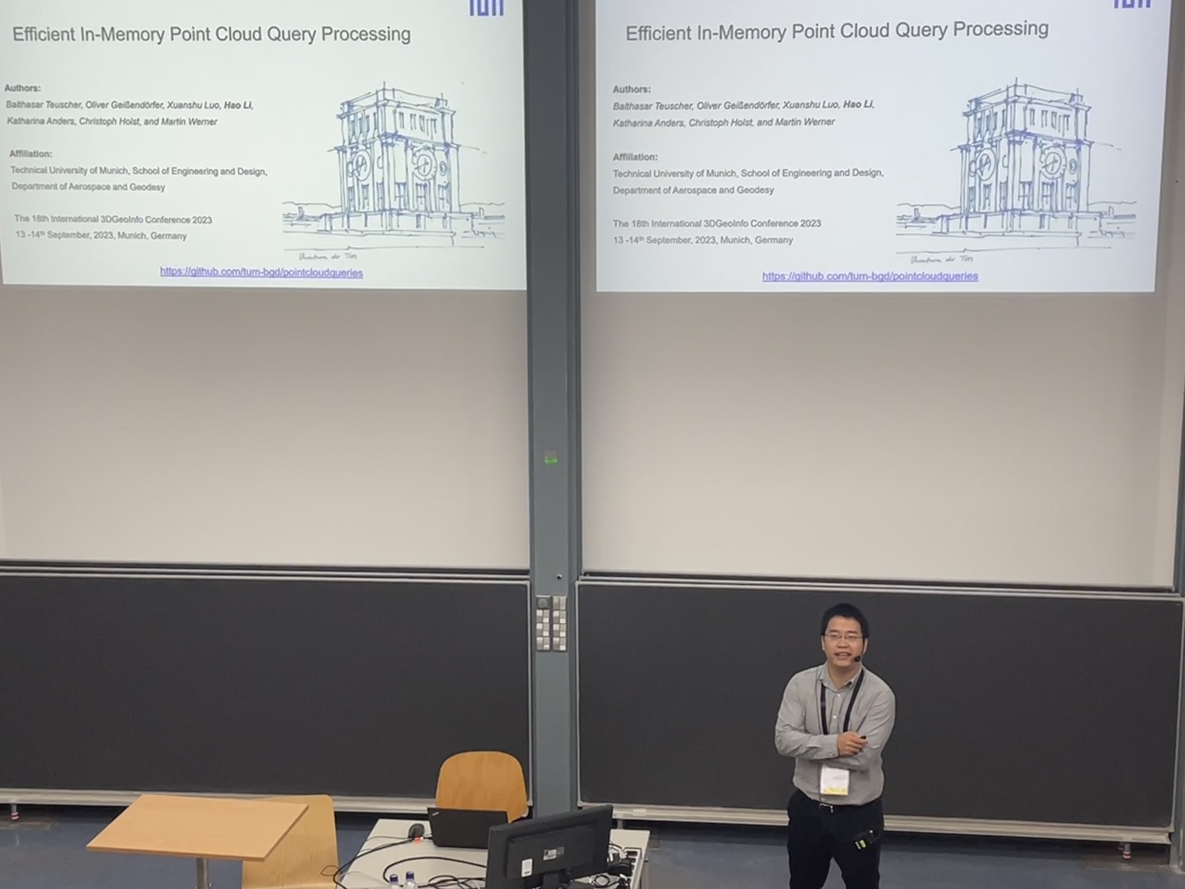
  • 3DGeoInfo 2023 talk on efficient point cloud query

    Hao Li presenting our paper at 3DGeoInfo 2023
    Hao Li presenting our paper at 3DGeoInfo 2023(c) 2023 H. Li

    Hao Li was presenting results of our efficient point cloud query paper (Teuscher et al., 2024) led by Balthasar Teuscher at the 18th 3DGeoInfo 2023 conference in Munich.

    In this paper, we propose an efficient in-memory point cloud processing solution and implementation demonstrating that the inherent technical identity of the memory location of a point (e.g., a memory pointer) is both sufficient and elegant to avoid gridding as long as the point cloud fits into the main memory of the computing system. During the conference, we have collected a handful of nice comments and suggestions for the participants, which will be integrated in the future development. This paper is a nice joint effort with TUM colleagues from Chair of Engineering Geodesy (Prof. Holst) and Professorship for Remote Sensing Applications (Prof. Anders).

    Resources

    1. Teuscher, B., Geißendörfer, O., Luo, X., Li, H., Anders, K., Holst, C., & Werner, M. (2024). Efficient In-Memory Point Cloud Query Processing. In T. H. Kolbe, A. Donaubauer, & C. Beil (Eds.), Recent Advances in 3D Geoinformation Science (pp. 267–286). Springer Nature Switzerland. https://doi.org/10.1007/978-3-031-43699-4_16 [PDF] [Online]
  • CERN Openlab Summer Student Programme Talk on Quantum Machine Learning and Optimization

    Carla Rieger was a speaker in this year’s CERN Openlab summer student programme, where she presented on Quantum Machine Learning and Quantum Optimization. Furthermore, her talk was showcasing successful CERN use-cases to illustrate current practical applications of quantum algorithms in the field.

    Carla Rieger presenting at the CERN Openlab summer student lecture programme.
    Carla Rieger presenting at the CERN Openlab summer student lecture programme.(c) 2023 C.Rieger

    More details, including the lecture slides and a recording of the talk, can be found here.

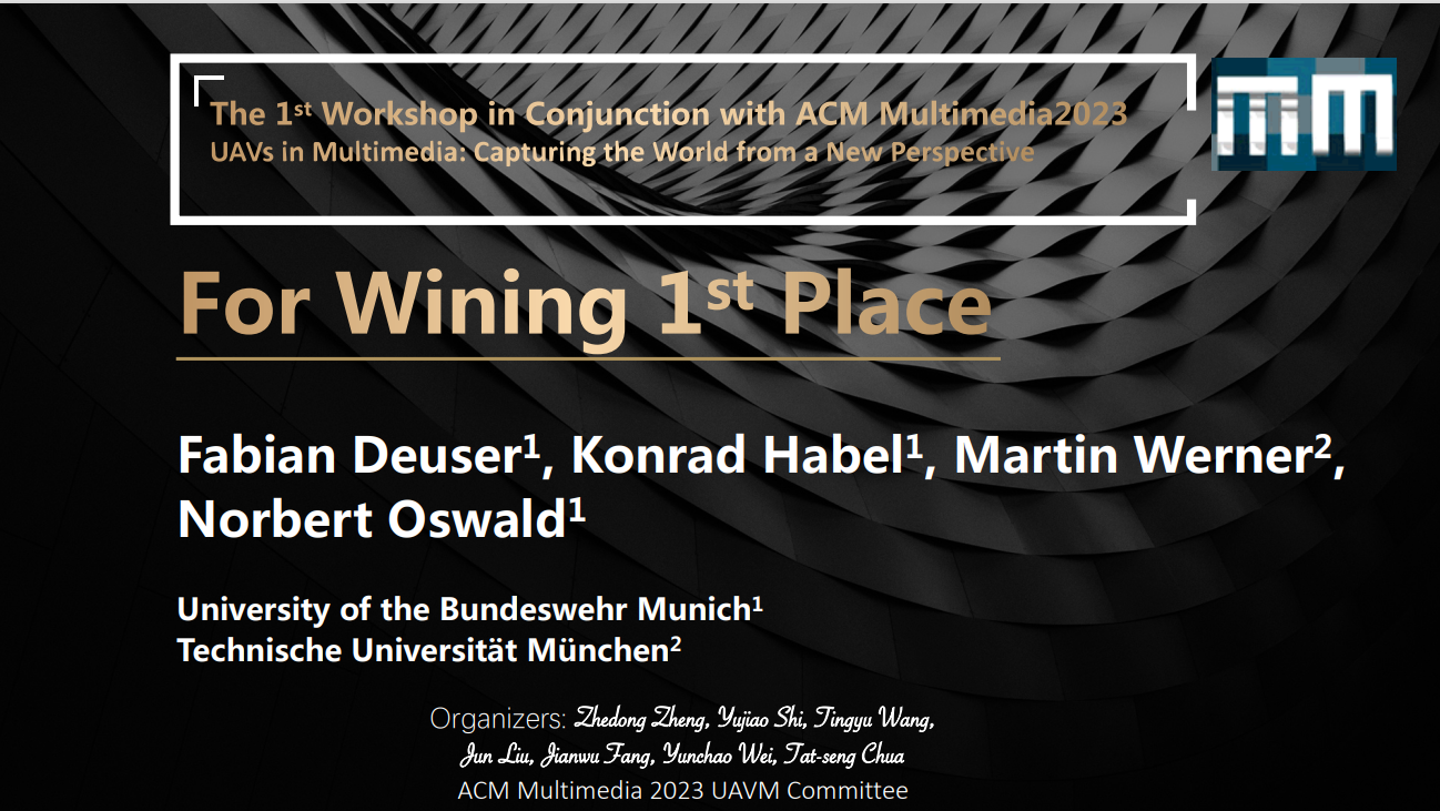
  • First place in the cross-view geo-localization competition at the ACM Multimedia

    Certificate of Achievement
    Certificate of AchievementACM 1st Workshop on UAVs in Multimedia

    We are proud to announce that a team led by Fabian Deuser won the first place at the cross-view geolocalization competition.

    In this challenge, the organizers presented a novel, challenging cross-view geo-localization dataset, called University160k. The motivation was to provide a comparably large satellite-view dataset for geolocalization to increase the number of similar features in different images. With a strategy of using pseudolabels to get a good alignment of latent space features and the localization problem, we were able to outperform all other submissions in the challenge. A paper on this topic is accepted and will be presented in the workshop.

    Congratulations to our fresh (first month?) PhD student Fabian Deuser, who was the lead in all of this work.

    This challenge has triggered a new line of research in our group as we believe that the true geolocalization problem is even harder than already depicted in the enlarged University160k dataset. On the other hand, the localization problem is typically a local problem as a coarse location might already be known in most applications. Furthermore, we will extend this activity to the indoor space, where even a limited-scalability reliable indoor geolocalization from images would be very helpful.

    So stay tuned for the workshop presentation, the paper, and our follow-up work maybe including additional geolocalization challenges.

  • SoilCarbonHack(athon)

    In cooperation with the Chair of Soil Science at the Technical University of Munich, the Professorship Big Geospatial Data Management is hosting a hackathon as part of the project SoilCarbonHack.
    Please refer to the project page for detailed information on the project and events.

    When?

    12.10.2023 - 13.10.2023

    Where?

    Room 0120 in 0501 Institutsbau
    Technical University of Munich
    Arcisstraße 21
    80333 München

    Contact

    Johann Maximilian Zollner
    [email protected]
    Professorship of Big Geospatial Data Management
    Lise-Meitner-Str. 9
    85521 Ottobrunn

    Yahan Hu
    [email protected]
    Chair of Soil Science
    Emil-Ramann-Straße 2
    85354 Freising

  • Talk on Foundation Models for GeoAI delivered by Prof. Wenwen Li

    Prof. Wenwen Li  presenting her latest research on geospatial image interpretation and foundation models for GeoAI
    Prof. Wenwen Li presenting her latest research on geospatial image interpretation and foundation models for GeoAI(c) 2023 M. Werner

    On July 13, the room was packed with colleagues and students when Wenwen Li revealed to us her experience from adapting vision foundation models to geospatial images. It was very interesting for all of us and as the discussion grew into a long session shows how important this topic is.

    In order to sustain the exchange and to turn the frontal oneway communication of such a presentation format into a more valuable interactive exchange, we organize a follow-up and lessons learnt session in three months.

    Resources

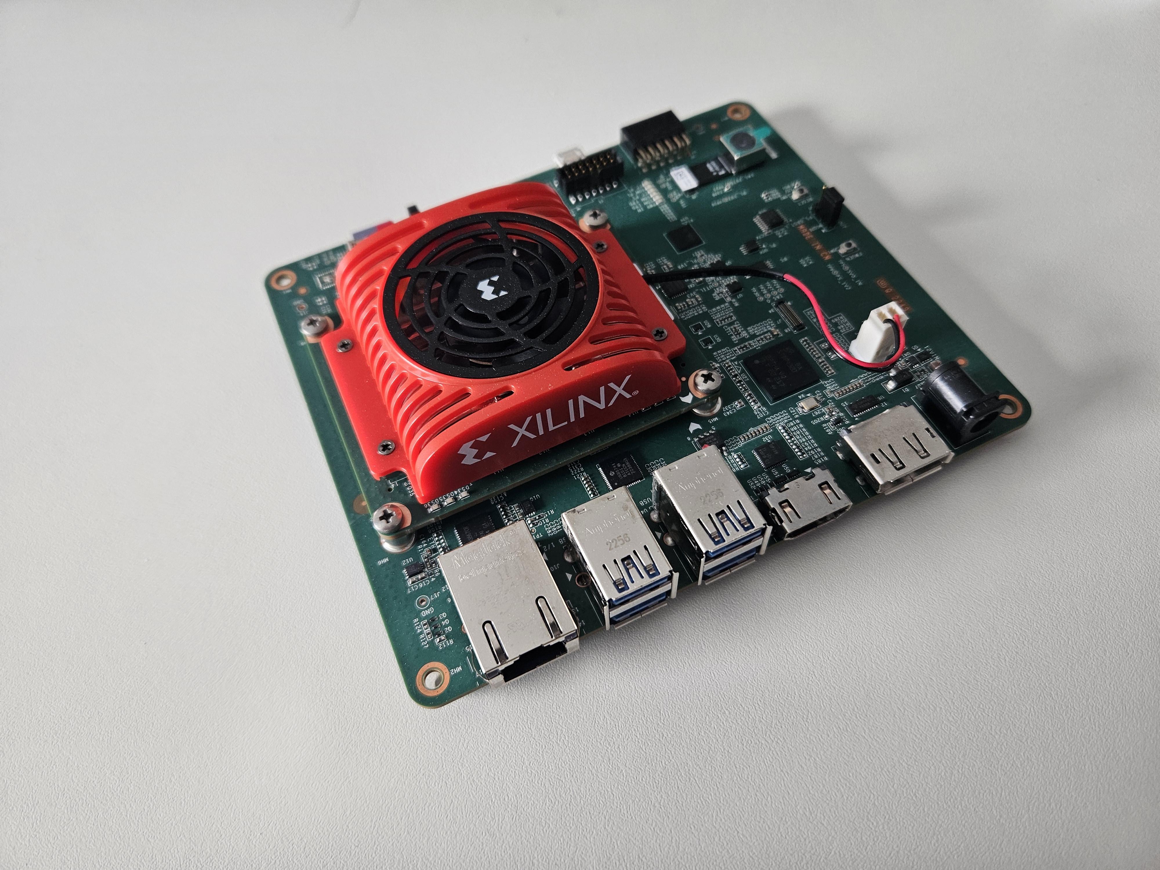
  • A new vision kit for our lab

    The Xilinx KV260 board brings a Xilinx SoC with camera peripherals onto a 10cm x 10cm board
    The Xilinx KV260 board brings a Xilinx SoC with camera peripherals onto a 10cm x 10cm boardImage: Martin Werner

    A novel teaching aid in our lab. The Xilinx AI System KV260 provides all you need for embedded and mobile AI applications. Full FPGA board with a small form factor. Easy to use as it runs a Ubuntu Linux.

    Students will learn more about mobile AI with this excellent board.

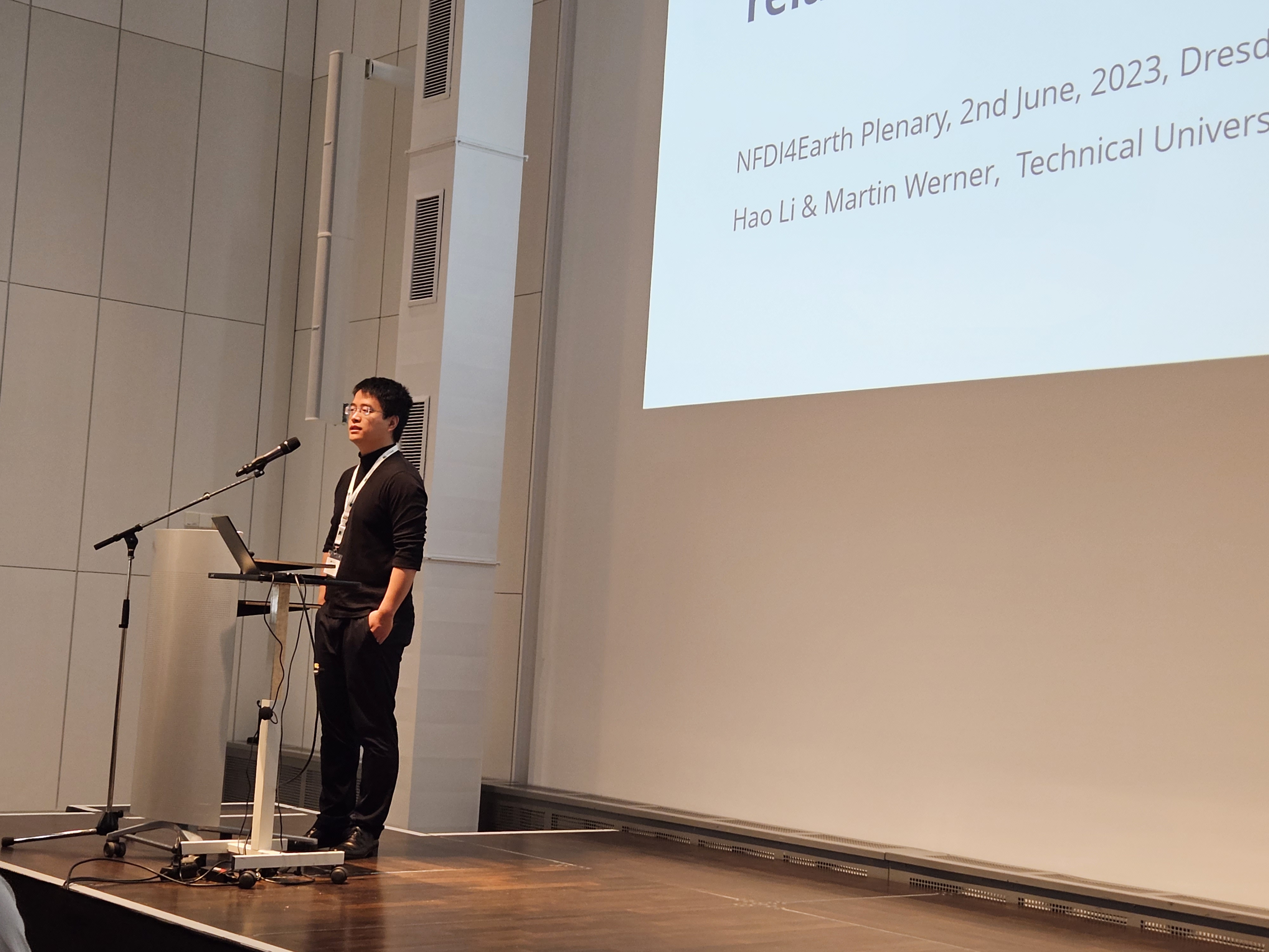
  • Talk at NFDI4Earth Plenary

    Hao Li presenting our Atlas4Water Incubator Project at NFDI4Earth Plenum
    Hao Li presenting our Atlas4Water Incubator Project at NFDI4Earth Plenum(c) 2023 M. Werner

    Hao Li was presenting aspects of our AtlasHDF infrastructure (Werner & Li, 2022) which was explored for surface water segmentation in the context of NFDI4Earth.

    In a nutshell, we propose a shift in geospatial big data from Geo to NoGeo quite in the same way as the big data community sacrificed the SQL language in big data towards NoSQL infrastructures. OGC standards and their libraries are valuable assets for data management, interpretation, and preservation. But they have never been designed for computation. While our approach is less powerful in spatial operations at the moment, we have zero dependencies beyond HDF5. But this is mature, stable, and - most importantly - an integral part of both tensorflow and pytorch. The philosophy of this approach is simplicity: our data can be used by every deep learning scientist out of the box. And the best: supercomputers read it in parallel…

    Resources

    1. Werner, M., & Li, H. (2022). AtlasHDF: An Efficient Big Data Framework for GeoAI. 1–7. https://doi.org/10.1145/3557917.3567615 [PDF] [Online]
  • Aerospace Bachelor startet

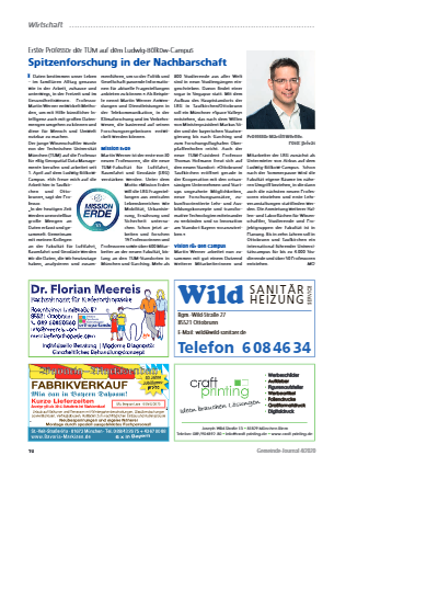
    Mit dem neuen Semester kommen die allerersten Studierenden an die TU München, die unseren neu eingerichteten Bachelor Aerospace studieren. Wir beteiligen uns an diesem Studiengang mit den beiden Informatik-Vorlesungen (“Computational Foundations I”, “Computational Foundations II”) und unterrichten darin die Grundlagen der Algorithmik, des Programmierens, und der technischen Informatik, sodass unsere Studierenden auch missionskritische Software entwickeln können. In Zeiten der Digitalisierung gibt es wohl kein Fach, bei dem die langfristige theoertische Fundierung (Informatik als Fundament aller Datenwissenschaft) genauso wichtig ist wie tatsächliche praktische Fähigkeiten (Software als universelles Werkzeug). Entsprechend folgen wir dem didakstischen Ansatz 4CID, bei dem vor allem das Lernen durch prakstiche Aufgaben in prozeduraler (Schritt für Schritt: Steigende Komplexität mit abnehmender Hilfestellung) und thematischer Einbettung (Anwendungsbeispiele) im Vordergrund steht.

    Wir freuen uns auf diese neue Vorlesungsreihe, die in Teilen übrigens auch im nächsten Semester im Studiengang Geodäsie und Geoinformatik zur Anwendung kommen wird.

  • MINT Entdeckerinnen 2021

    Auch in diesem Jahr haben wir uns wieder am Programm MINTEntdeckerinnen der TU München beteiligt. Sechs junge Frauen im Alter zwischen 15 und 18 Jahren waren bei uns in den Schulferien zu Gast, um Erfahrungen in unserem Bereich zu sammeln.

    In diesem Jahr haben wir als Thema “Autonome Flugdrohnen” ausgewählt und im Rahmen eines Hackathon-Kurses alle notwendigen Elemente gelernt und ausprobiert, mit denen man autonome Drohnen simulieren und die nötige Software entwickeln kann.

    Wir haben MATLAB und SimuLink kennen gelernt, uns mit der Spiele-Engine Unity auseinandergesetzt, eine Simulation für die Flugdynamik der Drohne in MATLAB umgesetzt und mit der Spiele-Engine verbunden. Am Ende konnten wir Trajektorien planen, abfliegen, und ein Safe-and-Rescue-Szenario lösen.

    Die ein oder andere Drohne ist in der Simulation abgestürzt oder durch Häuser geflogen, aber am Ende haben alle sechs Schülerinnen das Problem selbstständig und praktisch gelöst.

  • Gastvorlesung - Space Data Strategy: How to Gain Business Value from Geospatial Data

    Wir freuen uns über eine Gastvorlesung im Rahmen der Veranstaltung Big Geospatial Data:

    Friday, July 31st,2020 13:00 – 15:00 CET.

    In order to attend, you need to register for this lecture.

    Registration Information

    Speaker

    Martin Szugat

    Abstract

    Companies are drowning in data, but are thirsty for information. Although e.g. ESA’s Copernicus Open Data Strategy has exploded the availability & quality of geospatial data, only a small number of companies are using it. Because most companies only see their own data instead of seeing the opportunities and looking for new data. A data strategy is the business plan for data & analytics and data thinking is the method to develop this business plan. In this lecture you will get to know some useful tools to design data products yourself.

    Vita

    Martin Szugat is the founder and managing director of Datentreiber, a data strategy consulting firm. For his projects e.g. for Roche, ProSiebenSat1 and many more, he applies design thinking to data science and has developed a method and open source tools for data strategy design. Besides he is the program director of the Predictive Analytics & Deep Learning World conferences in Europe. He studied bioinformatics at LMU & TUM. When he has free time, he devotes himself to AI and Space Data and tweets about it on http://acceleran.do. The presentation is mandatory for students of the lecture Big Geospatial Data and open for all interested guests.

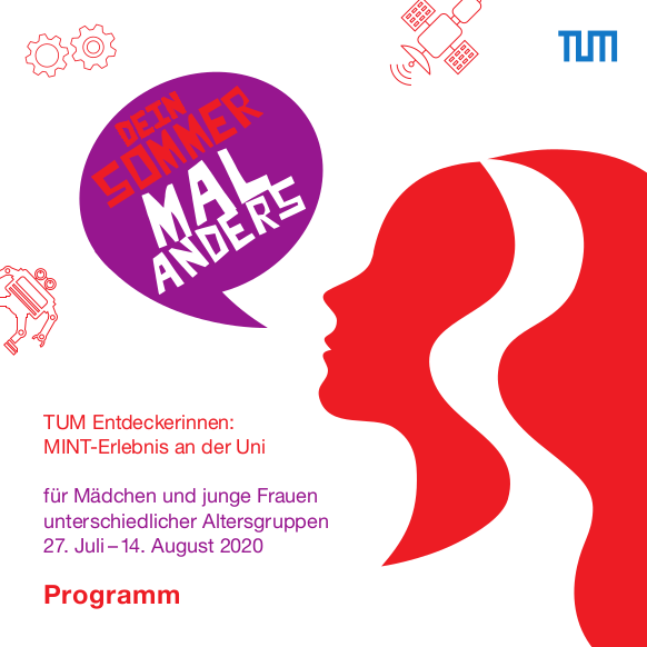
  • MINT-Erlebnis an der Uni - Programmbroschüre ist online!

    Wir freuen uns, dass das Programmheft für das diesjähring MINT-Erlebnis nun vorliegt.

    Die Professur für Big Geospatial Data Management ist mit einem Projektvorschlag vertreten, in dem Schülerinnen ab 16 Jahren einen Augmented-Reality-Sandkasten bauen.

    Die Broschüre und Informationen zur Anmeldung und zu Terminen gibt es unter <www.explore.tum.de/minterlebnis>

    Wir wünschen Ihnen ganz viel Freude beim Durchblättern!

  • Lehrmaterialien online

    Die ersten Lehrmaterialien für das Sommersemester 2020 sind online udn Zugangsdaten zur Online-Lehre verschickt. Wenn ihr nichts bekommen habt, schreibt eine E-Mail, wir kümmern uns so schnell wie möglich. Wir treffen uns online (Zoom) morgen um 9:45 zu einem Kennenlernen.

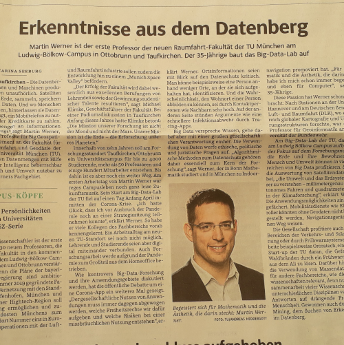
  • Prof. Martin Werner beginnt an der TU München

    Heute trete ich an der TU München meine Professur für Big Geospatial Data Management an. Es sind besondere Zeiten, in denen sich ein Virus weltweit ausbreitet und Wirtschaft und Gesellschaft lahmlegt. In dieser Situation ist leider eine Party anlässlich meiner Berufung nicht denkbar, aber wir werden diese Feier nachholen, sobald ich mein “Big Geospatial Data Lab” eingerichtet habe und wir uns wieder in der Öffentlichkeit treffen können.

    Nun konzentrieren wir uns erstmal auf die herausfordernde Aufgabe, auch im Internet gute Lehre und auch im Home-Office gute Forschung umzusetzen.

    Ich freue mich auf die Herausforderungen!

  • Valentinstag auf Twitter

    German version

    Valentines day is a very dominant hashtag. The following shows a very short excerpt of the Twitter 1% public stream. Look at how Valentines day dominates hashtag distribution for this day.


© 2020 M. Werner